Call Toll Free 866-448-3070
Every once in a while someone booking a two night stay at our Gatlinburg area Bed and Breakfast will ask if there is something to keep them busy for that length of time. Jeepers! Just skip to Day Thirteen on the list! Some folks may want to shop for a week; others want to hike for a week. I can help you with both. My second year in business a caller wanted to book a two-week getaway. I was afraid they would be bored and talked her out of it. What was I thinking! She ended up booking 11 days and since has become our most frequent repeat guest. So, ten years later, she was right, I was wrong, and this 18-day itinerary, with a little variety to give it spice, is a tribute to her and all my guests who have fallen in love with the Smokies.
 Trip 1- Cades Cove and the Great Smoky Mountains National Park
- Drive Cades Cove
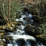
- Stroll, Walk, Hike the Middle Prong
- Dinner at Foothills Milling, Maryville
Day Trip Two
- Drive Roaring Fork Motor Nature Trail
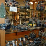
- Gatlinburg TN Arts & Crafts Community
- Dinner in Gatlinburg
Day Trip Three
- Shop Until One of You Drop at the Outlet Malls
- Dinner in Pigeon Forge
- Fly Fishing
- Dinner in Townsend
- Drive Parson’s Branch Road, Cades Cove
- Drive the Tail of the Dragon
- Fontana Dam
- Great Smoky Mountains Railroad, Bryson City
- Cherokee, NC
- Clingmans Dome
- Dinner in Gatlinburg, TN
- Thirty Three 2012 Festivals!
- Drive Cherohala Skyway
- Tail of the Dragon 318 Curves in 11 Miles
- Sunset at Look Rock on the Foothills Parkway
- Dinner in Townsend
- Hot Air Balloon Ride
- ATVing
- Hike with a Llama
- Tour the Winery in Pigeon Forge
- Catch one of Many Variety Shows
- River Rafting or
- Tubing the Little River
- Smokies Night Baseball Game
- Biltmore Estate and Winery
- Tuckalechee Caverns &
- Horseback Riding or
- The Lost Sea or Forbidden Caverns
- Little River Railroad Museum
- Great Smoky Mountain Heritage Center
- The Sinks
- Sugarlands Visitor Center
- Ober Gatlinburg
- Ripley’s Aquarium
- Massage
- Hot Tub
- A Few Games or a Long Nap
- Picnic Lunch Without Leaving your Rocker
- Sunset on the Veranda
- Dinner at Foothills Milling Company
- Antiquing in a 15 Mile Radius
- Bicycle Trails
- Area Golf Courses
- Classes at the Smoky Mountain Field School
- Dollywood or Splash Country